Gym nearby Gym Quilca
Peru
Gym nearby Gym Quilca
Gym Quilca
808-1000, BRT Metropolitano, 15001, Cercado de Lima, Provincia de Lima, PE Peru
contacts phone
:
+51
Latitude:
-12.0518799
, Longitude:
-77.0422808
larger map & directions
read more
nearest Gym
96 m
GIMNASIO JAGUAR GYM
Pedro Davalos 345, Cercado de Lima
Gym
read more
210 m
GIMNASIO GAJUAR GYM
Pedro Davalos, Cercado de Lima
Gym
read more
310 m
Cancha Zepita
Jirón Zepita 535, Cercado de Lima
Gym
read more
439 m
GIMNASIO APOLO GYM
Avenida Uruguay, Cercado de Lima
Gym
read more
470 m
Performance Sport Gym
Varela 339, Cercado de Lima
Gym
read more
503 m
Iron Gym Huaraz
Jirón Huaraz 480, Breña
Gym
read more
534 m
Asociación Peruana de Fútbol de Mesa - APFM
Jirón Camaná 978, Cercado de Lima
Gym
read more
615 m
Cancha de Fulbito El Fanático Fútbol Club
Piso 5, Avenida Uruguay 191, Cercado de Lima
Gym
read more
615 m
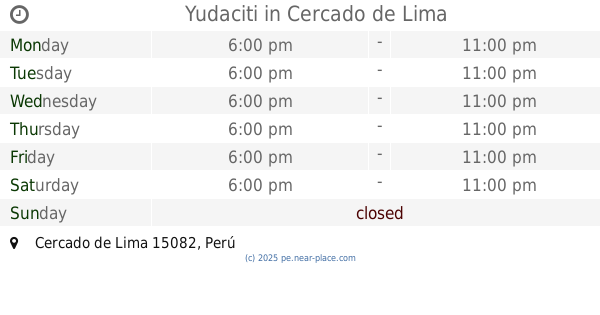
Yudaciti
Cercado de Lima
Gym
read more
615 m
Yudaciti
Lima District
Gym
read more
617 m
Estadio lolo fernandez
Sanchez Pinillos 341, Cercado de Lima
Gym
read more
633 m
cafferataperformance lima
Jirón Camaná 1153, Cercado de Lima
Gym
read more
636 m
FAUCETT
MALL AVENTURA PLAZA, Bellavista
Gym
read more
692 m
ACRODANCE
Avenida Rep. de Venezuela 1012, Cercado de Lima
Gym
read more
736 m
Santa Isabel, Carabayllo
Avenida España 323, Cercado de Lima
Gym
read more
774 m
Power Life Gym
Jirón Loreto 379, Breña
Gym
read more
776 m
Gym A+que
Jirón Loreto 366, Breña
Gym
read more
971 m
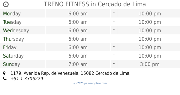
TRENO FITNESS
Avenida Rep. de Venezuela 1179, Cercado de Lima
Gym
read more
1.031 km
LA CANCHA Colonial 642
Avenida Oscar R. Benavides 648, Cercado de Lima
Gym
read more
1.041 km
Solgym
Lima District
Gym
read more
1.041 km
Solgym
Cercado de Lima
Gym
read more
1.187 km
MIVAN SPORT
Avenida Argentina 639, Cercado de Lima
Gym
read more
1.228 km
Escuela de Parkour de Lima Traceurs
Jirón Callao 350, Cercado de Lima
Gym
read more
1.685 km
Gimnasio Ferrari gym
Avenida Rep. de Venezuela 1783, Breña
Gym
read more
1.92 km
Kame H
Jirón Huaraz 1762, Breña
Gym
read more
📑
all categories
Accounting
Administrative area level 1
Administrative area level 2
Airport
Amusement park
Aquarium
Art gallery
Atm
Bakery
Bank
Bar
Beauty salon
Bicycle store
Book store
Bowling alley
Bus station
Cafe
Campground
Car dealer
Car rental
Car repair
Car wash
Casino
Cemetery
Church
City hall
Clothing store
Colloquial area
Convenience store
Courthouse
Dentist
Department store
Doctor
Electrician
Electronics store
Embassy
Finance
Fire station
Florist
Food
Funeral home
Furniture store
Gas station
General contractor
Grocery or supermarket
Gym
Hair care
Hardware store
Health
Hindu Temple
Home goods store
Hospital
Insurance agency
Intersection
Jewelry store
Laundry
Lawyer
Library
Light rail station
Liquor store
Local government office
Locality
Locksmith
Lodging
Meal delivery
Meal takeaway
Mosque
Movie rental
Movie theater
Moving company
Museum
Natural feature
Neighborhood
Night club
Painter
Park
Parking
Pet store
Pharmacy
Physiotherapist
Place of worship
Plumber
Point of interest
Police
Political
Post office
Premise
Real estate agency
Restaurant
Roofing contractor
Route
Rv park, camping
School
Shoe store
Shopping mall
Spa
Stadium
Storage
Store
Subpremise
Subway station
Supermarket
Synagogue
Taxi stand
Train station
Transit station
Travel agency
University
Veterinary care
Zoo
administrative area level 3
sublocality level 1
↑